


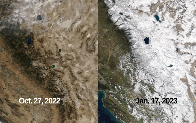
Weeks of torrential storms are resulting in California’s snowpack reaching record levels.
Currently at more than double the average for January, the snowpack – while early on in the season – is outpacing records set 40 years ago.
The big picture: California’s total snowpack currently sits at 245 percent of what is normal for this time, according to the latest data updated by the California Department of Water Resources.
- The snowpack also comes in at 126 percent of the April 1 average, the date when the state’s snowpack is typically at its greatest heading into usually dry summers, an especially important number given the severe drought over the past several years.
By the numbers: California separates the Sierra Nevada Mountains into three regions for its snowpack measurements – Northern Sierra, Central Sierra and Southern Sierra.
- As of Thursday, the Northern Sierra region is at 203 percent of what is normal for Jan. 19 and 103 percent of its April 1 average. The region has an average snow water equivalent of 29.3 inches.
- The Central Sierra region is at 248 percent of its average for the date, which also comes in at 129 percent of its April 1 average. The region has an average snow water equivalent of 35.2 inches.
- The Southern Sierra region is posting the largest snowfall numbers relative to its history – 287 percent of what is normal for Jan. 19 and 149 percent of its April 1 average. The average snow water equivalent is 33.1 inches.
What we’re watching: The current snowpack is outpacing the record-setting 1982-1983 season, but the snowfall four decades ago was close to 250 percent of what is normal by the start of May.
- Despite the great start, the heavy storms appear to be behind the Golden State, and as dry weather returns over the next couple weeks the snowpack could fall off.