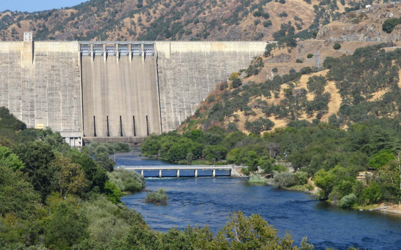
As the current series of storm events in California continues to bring much-above average amounts of snow and rain to the Sierra Nevada, and repeated heavy rainfall across the valley floor, the US Army Corps of Engineers Sacramento District has announced plans to begin a rare flood release into the old Tulare Lakebed.
This decision comes as the Kings River runoff season is shaping up to be a record, and increasingly serious high water prospects loom large.
The big picture: The flood release will begin with increased flows from Pine Flat Dam starting at 5 a.m. Monday. The releases will grow to 1,500 cubic feet per second (c.f.s.) at Army Weir north of Lemoore into the lower Kings River’s Clark’s Fork-South Fork system.
- Army Corps officials said the flood release toward the Tulare Lakebed would begin at 500 c.f.s. and be increased by 500 c.f.s. each day until reaching a target flow of 1,500 c.f.s. The North Fork system will also reach its capacity, with target flood release flows of 4,750 c.f.s. at Crescent Weir, south of Riverdale in the next several days.
- The South Fork flows are expected to begin in Kings County on Tuesday morning and reach 1,500 c.f.s. by Thursday afternoon.
- The South Fork flows are anticipated to continue indefinitely, possibly lasting until sometime in the summer.
- In addition, flows in Mill Creek, an unregulated foothill stream that enters the Kings downstream from Pine Flat Dam, are still several hundred cubic feet per second and expected to increase sharply with another Pacific storm due Monday through Wednesday.
- Releases from the dam will be reduced to accommodate Mill Creek flows. The Tulare Lakebed has been receiving flows for several weeks from the Kaweah and Tule rivers, Deer Creek, and several smaller creeks further south.
- Residents living along the river or feeder streams are advised to remain on alert for potential localized flooding due to the on-going releases from Pine Flat.
- The Kings River Water Association (KRWA) and its 28 member water agencies, along with the Kings River Conservation District (KRCD), will shepherd the flows destined for Tulare Lake through the river’s channels and control structures.
- The KRCD is responsible for of all Kings River channel flood operations and maintenance from the State Highway 43 bridge, north of Hanford, to just below Highway 41 near Stratford on the South Fork and McMullin Grade (Highway 145) on the James Bypass-North Fork channel.
By the numbers: With Pine Flat Reservoir’s storage now rising to more than 77 percent of its one million acre-foot capacity, the Army Corps’ action in increasing flood releases is aimed at creating room in the reservoir for any very high inflows resulting from additional rain or melting snow in order to minimize high water danger to properties and facilities along the river.
- Inflow to Pine Flat topped more than 40,000 c.f.s. during a recent storm but was mostly captured by the dam.
What they’re saying: KRCD General Manager David Merritt said they have performed a lot of maintenance on the levees and channels since the high flows of 2017 and will monitor operations closely.
- “River flows downstream from the dam are going to be climbing and will continue to be increased,” said Kings River Watermaster Steve Haugen, who manages the KRWA. “This could last into the summer.”
- Haugen said the Army Corps will constantly evaluate conditions and make flood releases changes as needed. He added total releases from Pine Flat Dam, which all of this morning were steady at more than 6,300 c.f.s., will be increased over the next few days to a range of 8,500-9,000 c.f.s., most of which will be flood release water.
- Some water will continue to be released for KRWA member units to supply groundwater recharge basins in parts of the one-million-acre Kings River service area.


