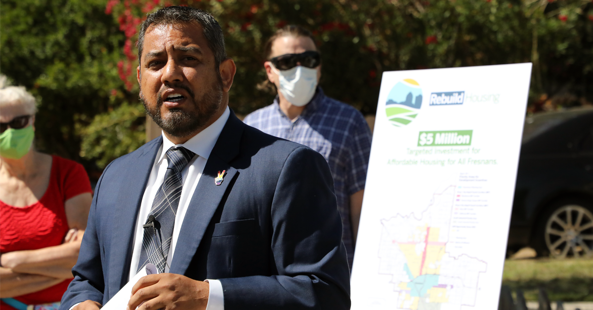
Possible new districts for Fresno City Council were previewed in a public hearing as part of Thursday’s council meeting.
There were 10 maps submitted for the hearing which were presented – seven from the public and three from city consultant National Demographics Corporation (NDC).
However, five of the maps did not comply with either federal laws regarding equal population or charter provisions.
All five noncompliant maps were submitted by the public. With an ideal population per district number coming in at 77,796, maps 103, 104, 105 and 106 (which can be viewed here) all had districts straying too far from that number.
Councilwoman Esmeralda Soria also noted that Public Map 101, which was initially considered compliant by NDC, did not follow charter provisions because it drew her out of her own district.
That left five maps – two from the public and three from NDC – as options to move forward with.
But even those raised questions about the number of majority Latino citizen voting age districts.
Currently, Fresno has three such districts (Districts 3, 5 and 7), and city consultant Chris Skinnell told the council that it would be prudent to focus on maps that follow the same population range as is currently represented.
“Given the history of successful Latino political power in Fresno, I don’t think I could say that any reduction at all would necessarily be a Voting Rights Act violation,” Skinnell said. “But I am concerned about any map that takes a majority Latino citizen voting age population district and drops, as some of these maps clearly do.”
The council did not provide any modifications or directions to the maps and will hold another public hearing regarding redistricting on Dec. 2.
There is no obligation for the council to approve any of the maps presented Thursday. The council may choose to move forward with one of the maps or consider another one.
Here is a look at the five maps presented Thursday that were compliant:
Public 102
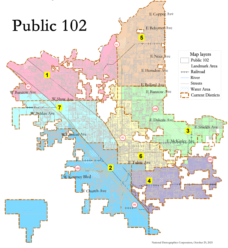
This map would see the districts remain very close to their current boundaries, despite numbering the districts differently.
On this map District 2 (currently District 3), District 4 (currently District 5) and District 6 (currently District 7) would have majority Latino voting age populations with 51 percent, 50 percent and 55 percent, respectively.
Public 107
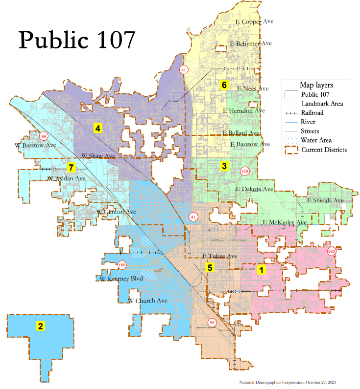
This map would drastically shift the districts. Four districts would all share a part of central Fresno, meeting at Highway 41 and Shields Ave.
A southeast district would be created that does not approach downtown, while District 6 in the north would lose part of its eastern block and push south on the west side and a northwestern district would be created that does not approach central Fresno.
Only two districts would have majority Latino voting age populations, District 2 with 51 percent and District 5 with 63 percent.
NDC Orange
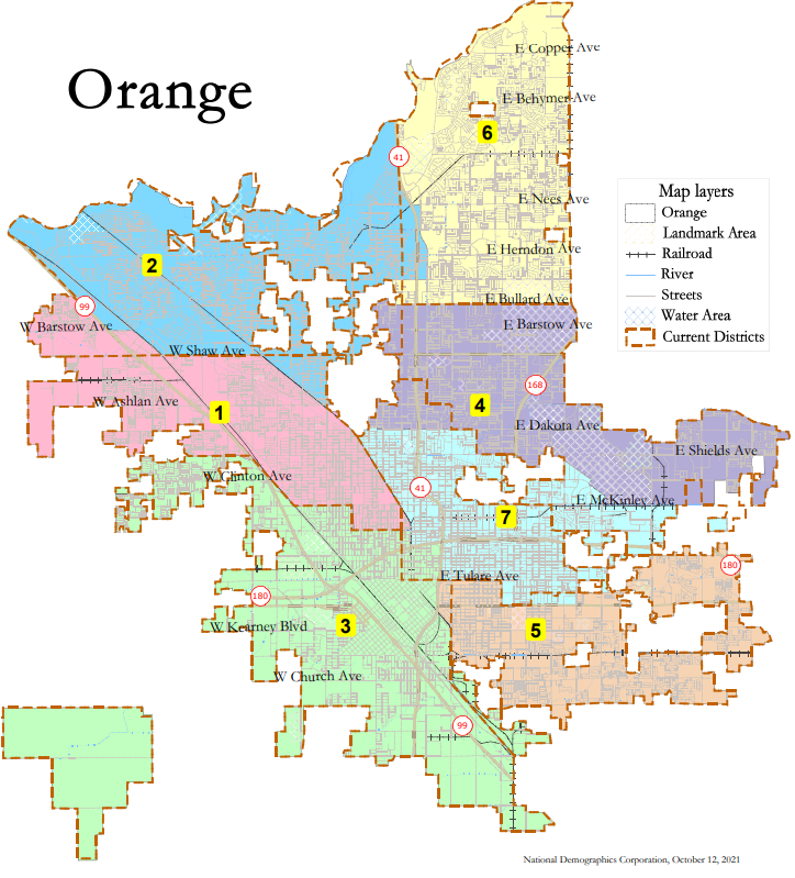
This visualization would see the current districts remain in relatively the same positions.
District 2 and District 1 would exchange areas west of Highway 99 and north of Shaw Ave. for a section near Fig Garden. Districts 4 and 7 would also exchange areas in central Fresno and in the east near McKinley Ave. and Willow Ave.
Per this map District 3 (51 percent), District 5 (51 percent) and District 7 (56 percent) would all contain majority Latino voting age populations.
NDC Tan
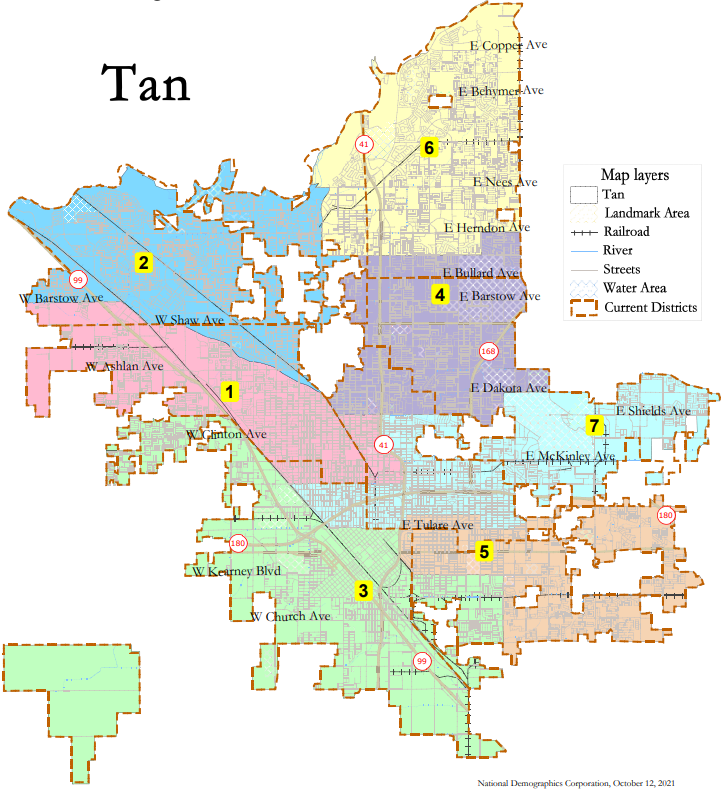
This map would see Districts 1, 4, and 7 meet in Central Fresno, while District 7 would see a major shift to the east.
District 3, District 5 and District 7 would have majority Latino voting age populations, with 52 percent, 50 percent and 51 percent, respectively.
NDC Green
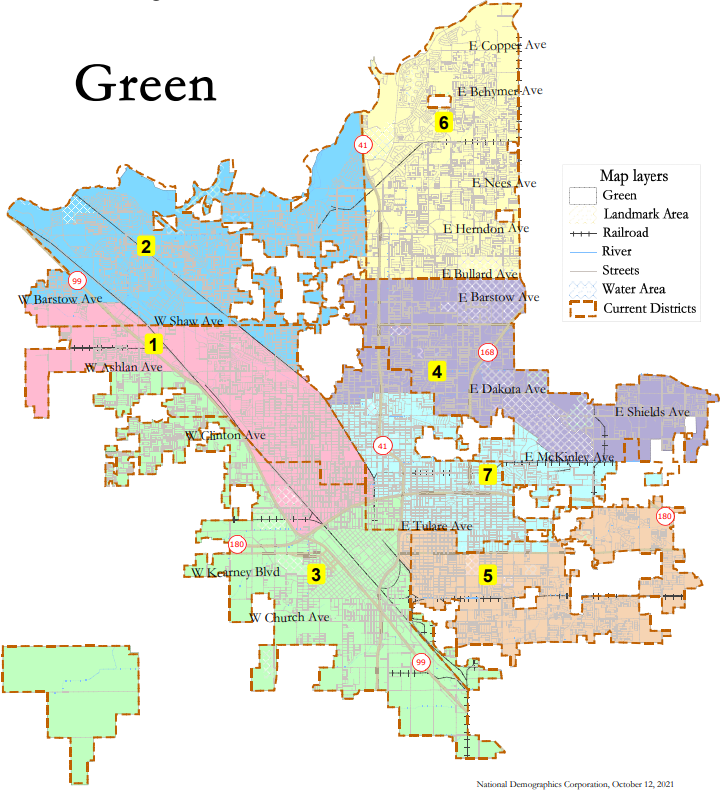
This visualization would see major exchanges with Districts 1 and 3. District 3 would expand further north on the west side of Highway 99 while DIstrict 1 would expand south to the Highway 99 and Highway 180 interchange.
Like the Public 107 map, the NDC Green map would cut one of the latino majority voting age districts as District 5 would have 51 percent and District 7 would have 56 percent.


